By Richard Bideau.
A damp morning in February 2024 was the setting for a reconnaissance ride of the Circuit Of Ingleborough course. The day featured a light wind from the southwest, ocassional rain, a great deal of mist and a chilly temperature of 6°C – conditions very similar to those on most of my eight competitive rides. This would have been a good day for the event. The pictures give a good indication of what to expect.
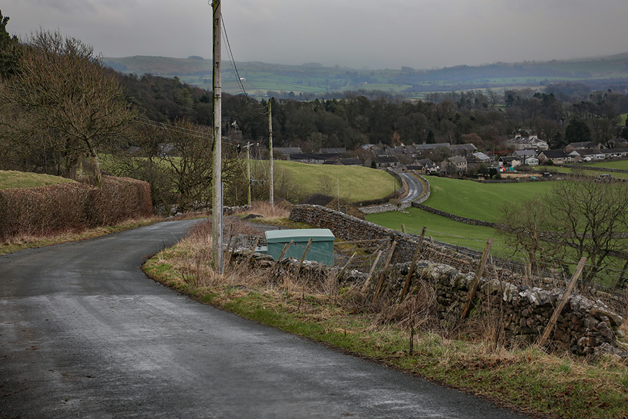
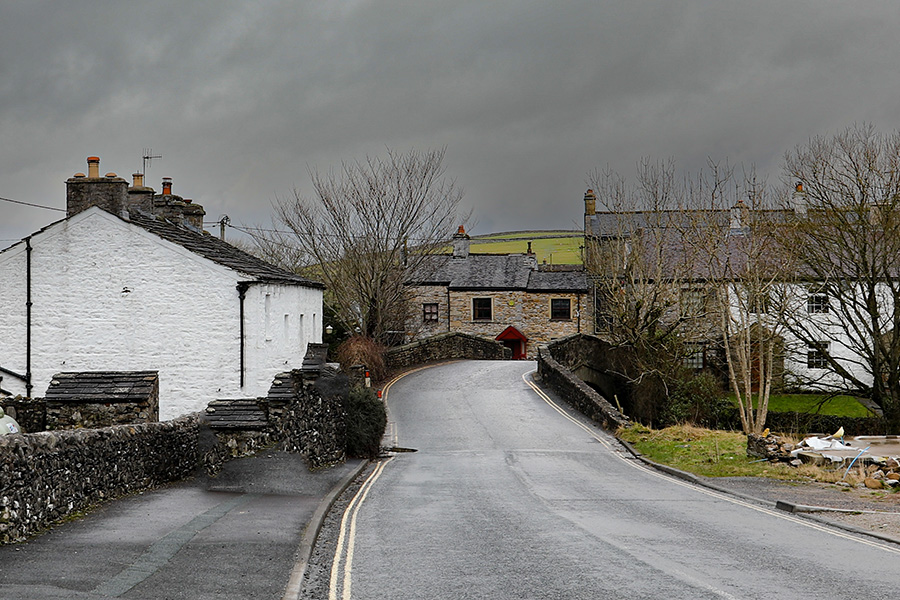
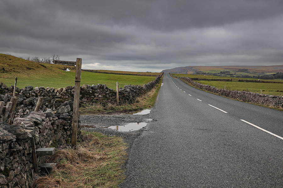
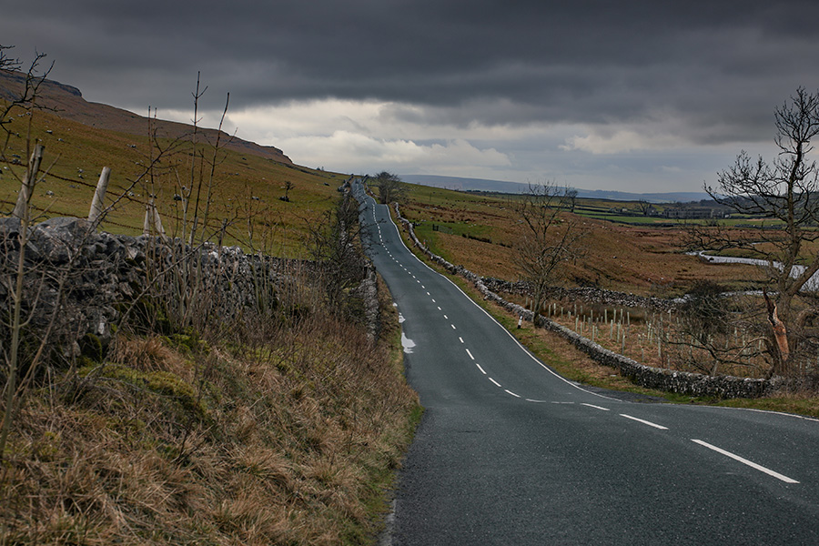
The start
The start is next to the farther utilty pole.
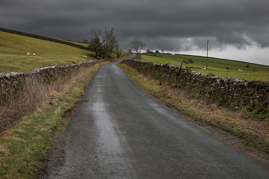
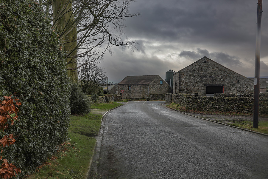
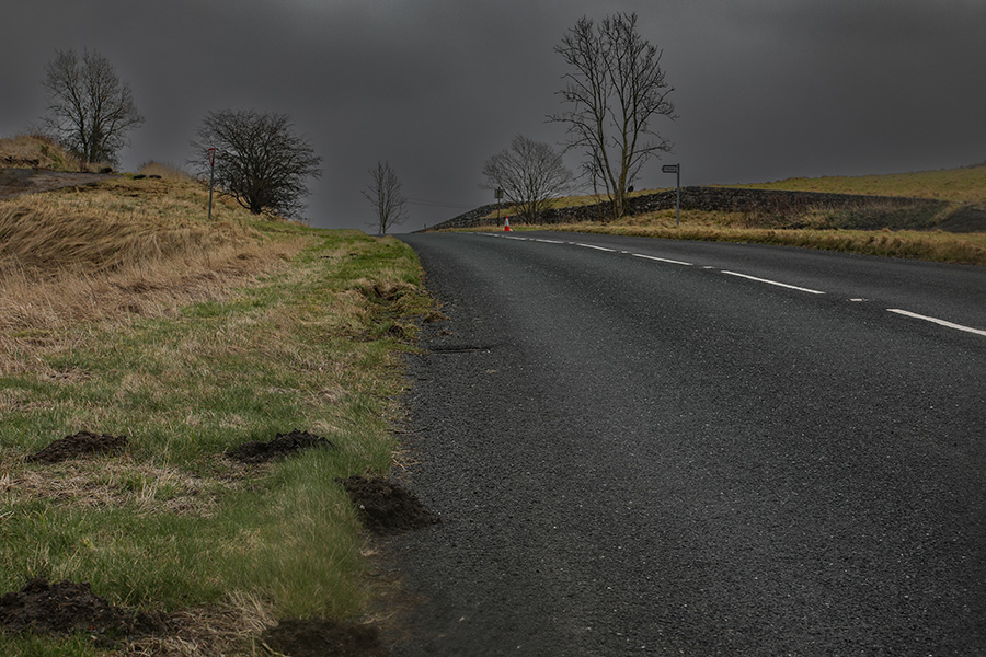
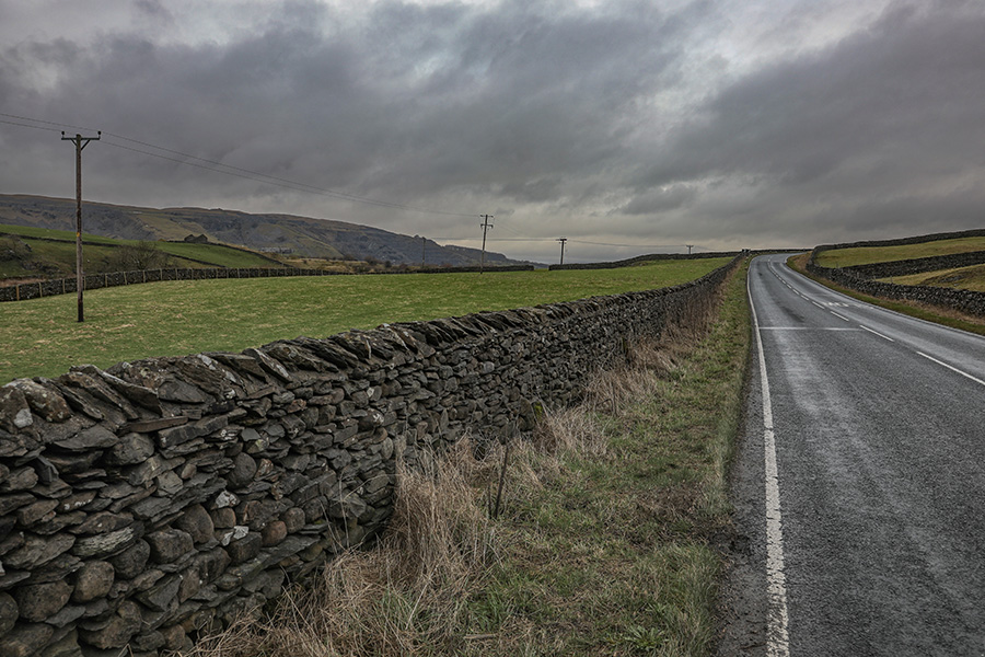
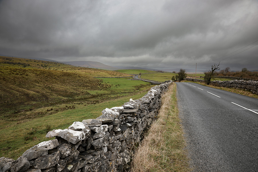
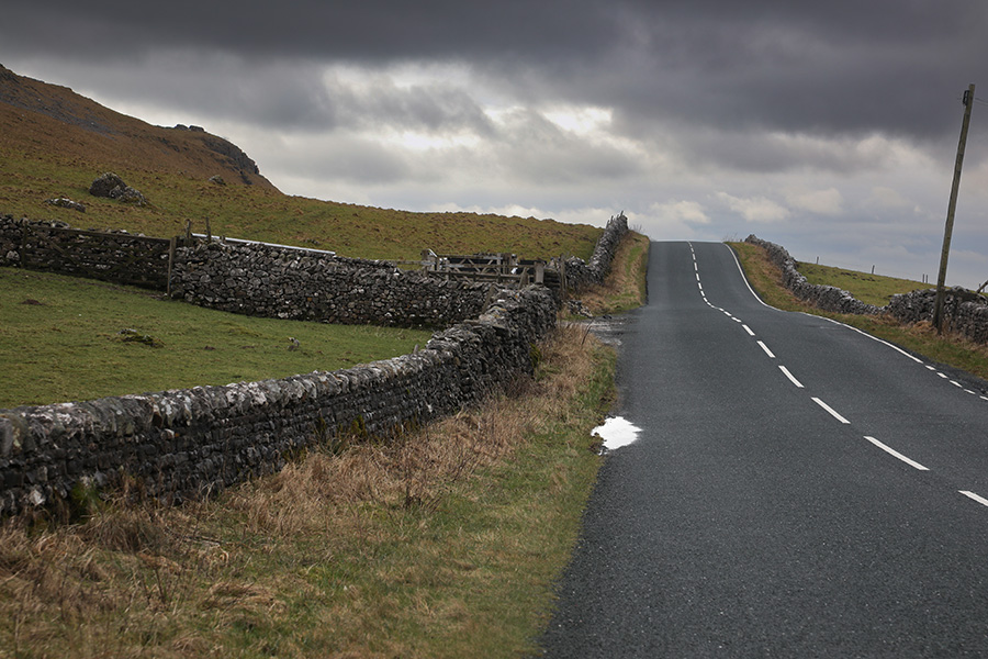
First climb
The climbing starts almost immediately, there is no gentle introduction. Care is needed as the road passes by several farms on the way to Clapham.
Distance completed: 0.18 miles
Total climbing: 12 ft
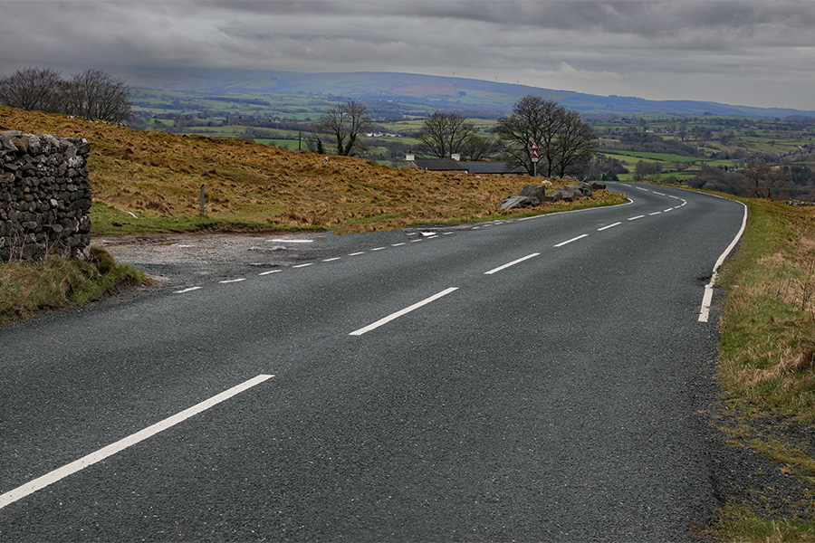
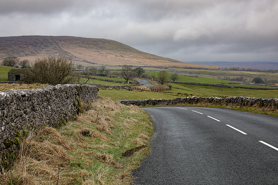
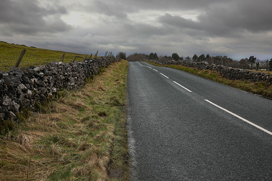
The climb continues
Approaching the first summit, the climb continues.
Distance completed: 1.08 miles
Total climbing: 243ft
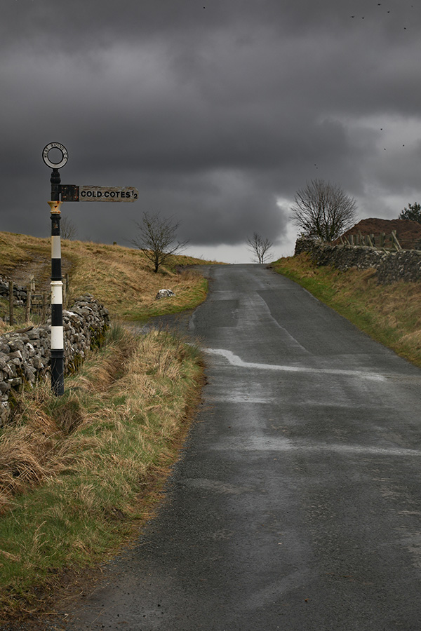
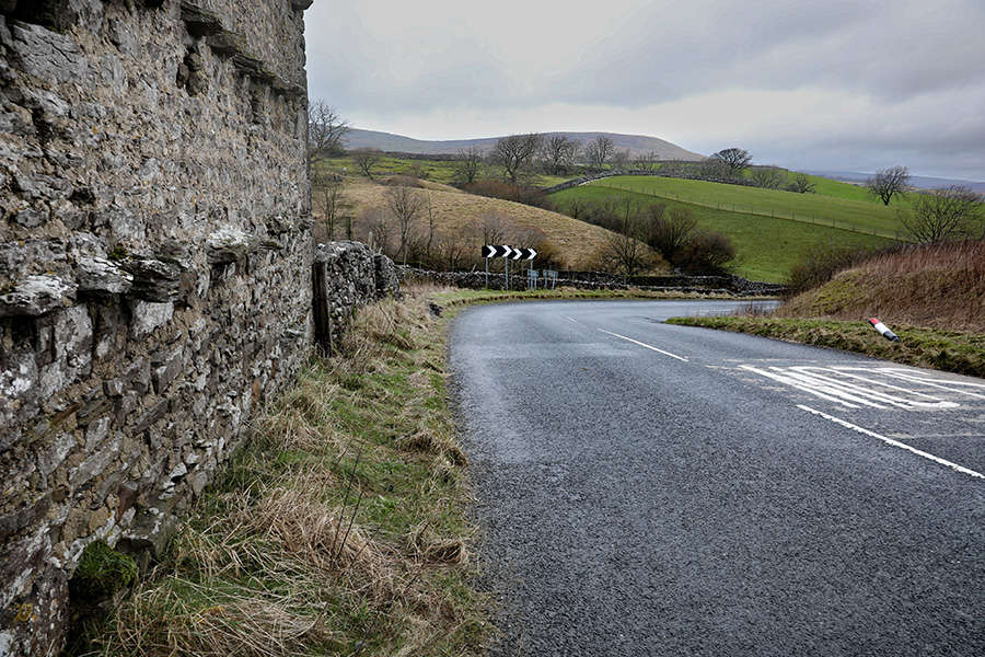
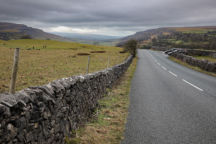
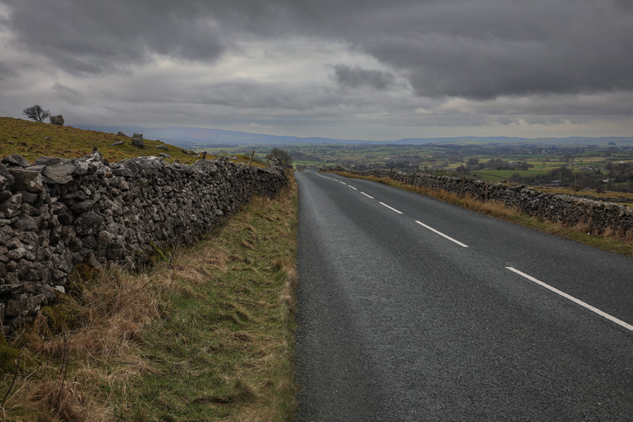
The first summit
The sign for Cold Cotes and the first summit approaches. This is a place of pain but respite is near.
Distance completed: 1.32 miles
Total climbing: 296 ft
Start of the descent to Clapham
The first summit passed and the road dips towards Clapham.
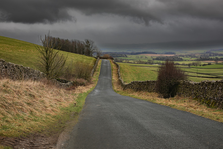
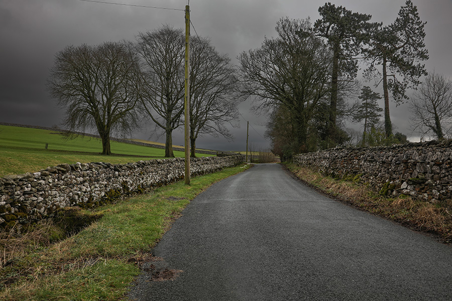
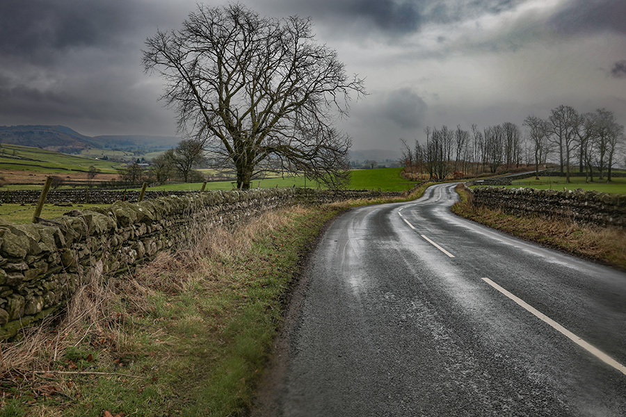
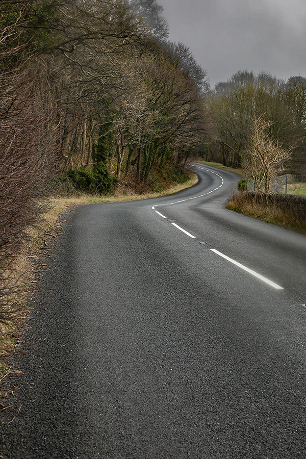
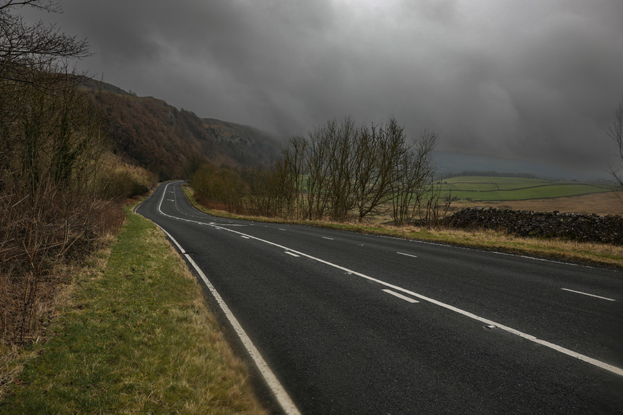
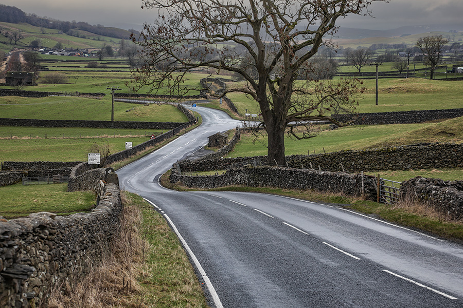
Clapham Old Road
The road continues the descent. A series of sinuous bends demand constant attention.
The Clapham Bends
The final section into the village is steeper and the bends are tight. These are handling limited – great care is needed.
Distance completed: 2.93 miles
Total climbing: 325 ft
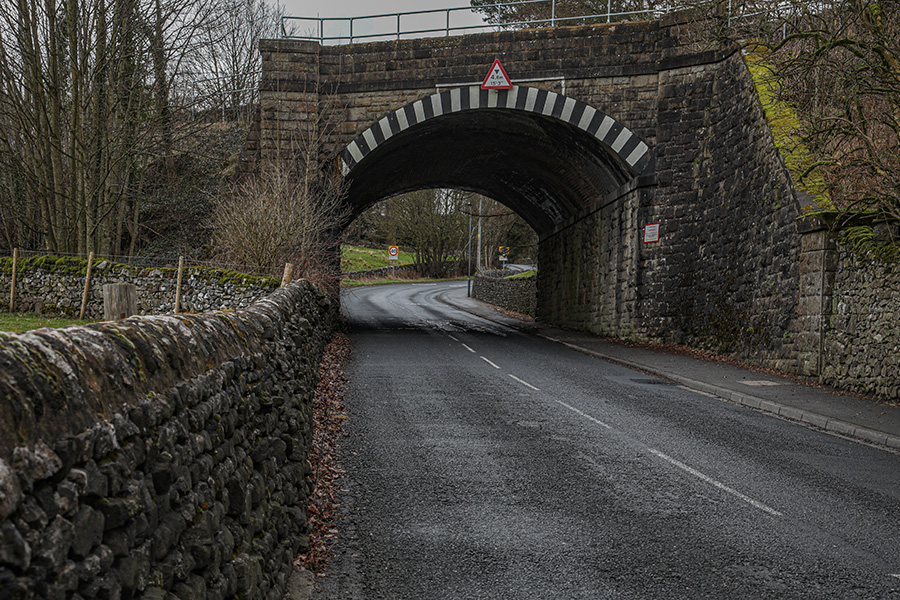
Left Turn into Clapham
The first encounter with a junction, a left turn into the village. Marshals will point the way here.
Distance completed: 3.54 miles
Total climbing: 328 ft
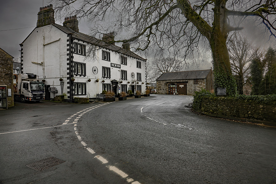
Clapham Village
Take care over the bridge and the right-left bend combination at the pub.
Out towards the A65
For the first time a section to suit the time trial specialist. A flat section with gentle bends. Here is a place to put the hammer down and revel in speed.
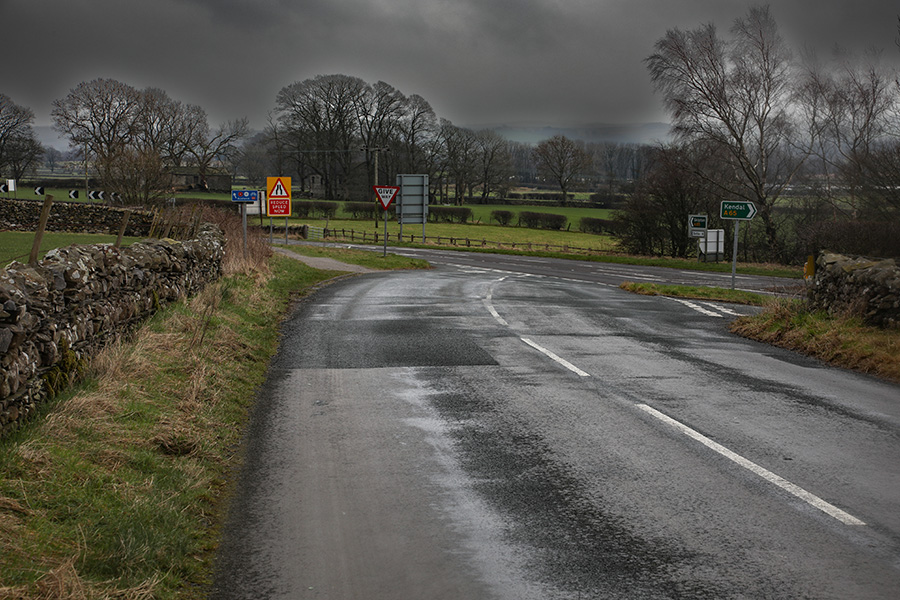
Junction with the A65
The second junction – left onto the A65. Traffic is approaching at speed from the right. You must look right and stop if the way is not clear. The marshals here will only indicate the direction to take.
Distance completed: 4.44 miles
Total climbing: 336 ft
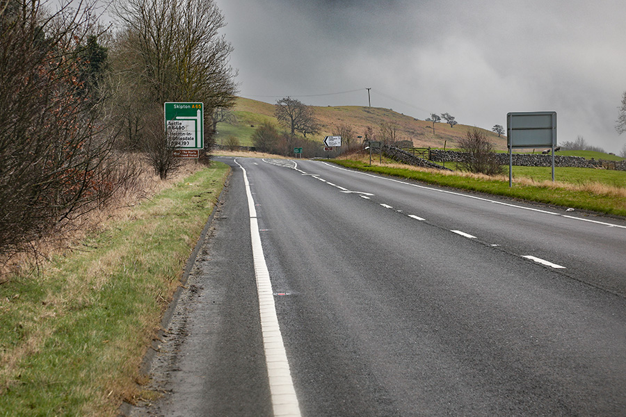
The A65
The brief section on the A65 is quite tough. There are numerous short rises and falls, bends and side junctions. It can be hard to keep a steady rhythm here.
Distance completed: 5.06 miles
Total climbing: 360 ft.
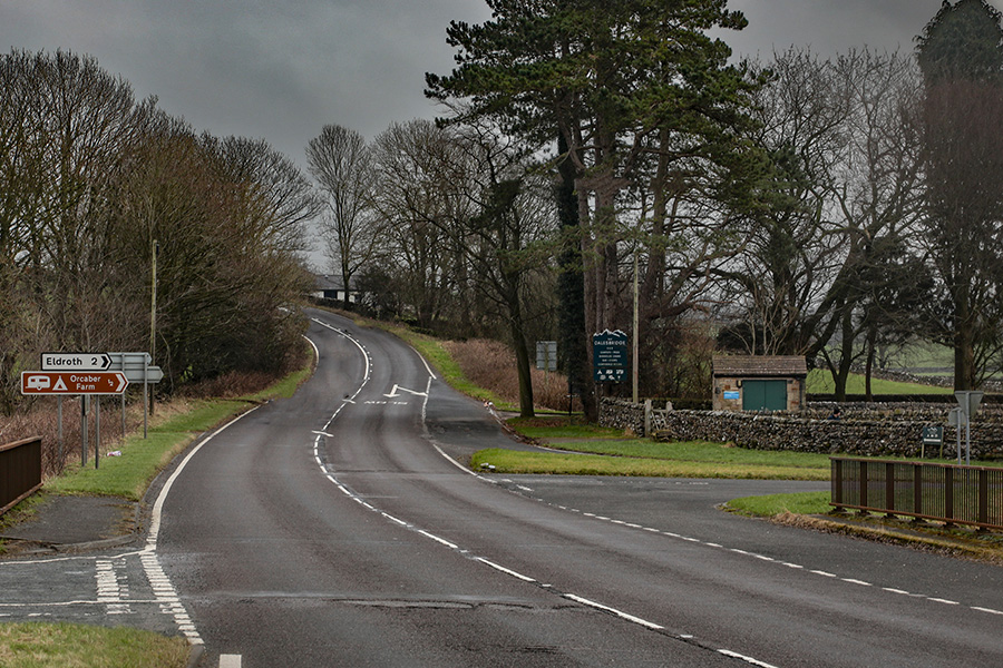
Left off the A65
The left turn to Settle off the A65 brings an abrupt change, another sharp climb is coming up.
Distance completed: 6.91 miles
Total climbing: 538 ft
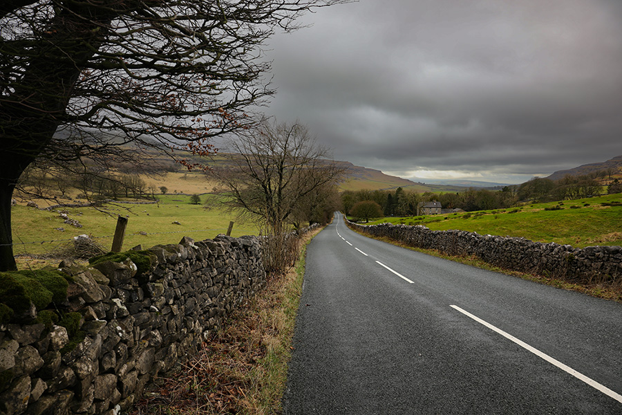
The climb to Buckhaw Brow
The second climb, this one is quite short but it can take its toll.
Almost there
The summit is in sight, with the sign to Feizor on the right, the climb is almost done.
Distance completed: 7.50 miles
Total climbing: 703 ft
And now for something completely different…
The first big plunge. From Buckhaw Brow, the road drops steeply towards Settle. Though Giggleswick scar appears grandly on the left, the rider needs to focus on this extremely fast section. Among the trees great care is needed with rapidly varying light.
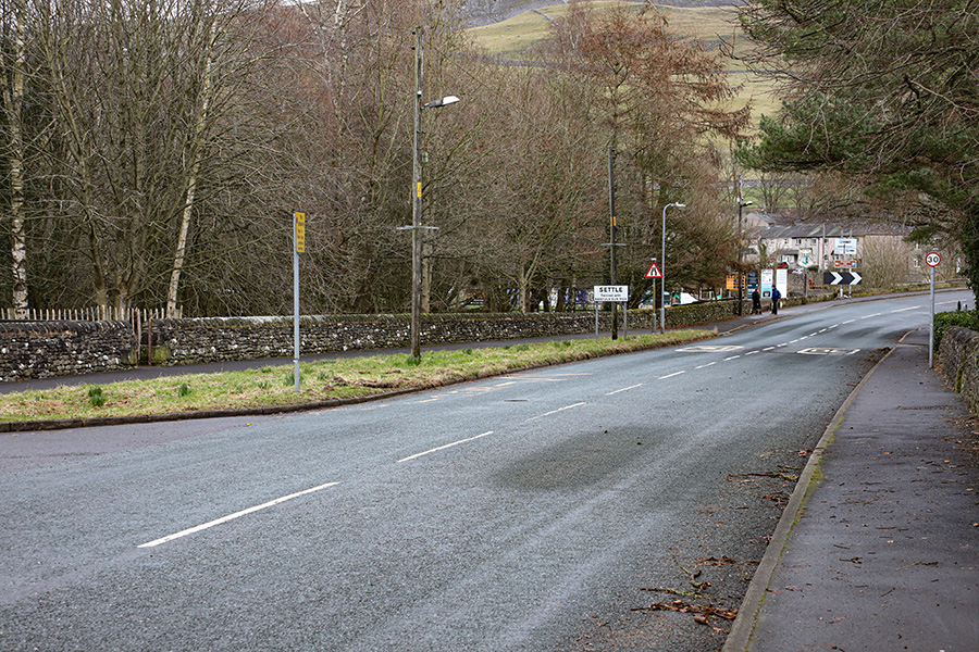
Settle
With speed still carried from the big drop, Settle approaches. Over the Ribble and it is an immediate left, turning North onto the next section. Marshals will point the way here.
Distance completed: 9.51 miles
Total climbing: 730 ft.
Starting North
On a windy day the turn at Settle brings a change in character. If it is a tail wind here, then the next sections will be a lot easier.
The climbing starts
The first encounter with the Settle-Carlisle railway and also the first of many short climbs. It was here, in 2023, that my ride started to go wrong. I had set off too hard and the rest of the ride was an ordeal.
Distance completed: 10.00 miles
Total climbing: 761 ft
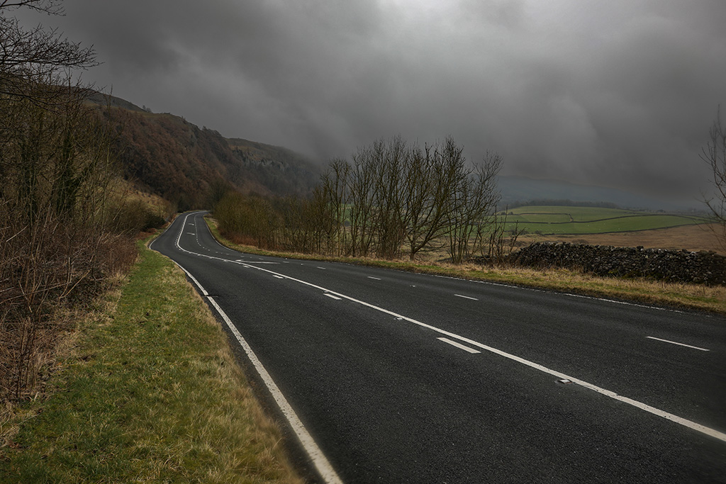
Langcliffe Scar
A fast downhill section brings Langcliffe Scar into view.
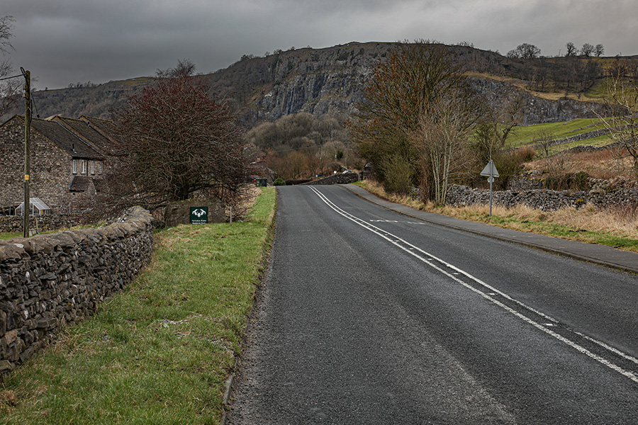
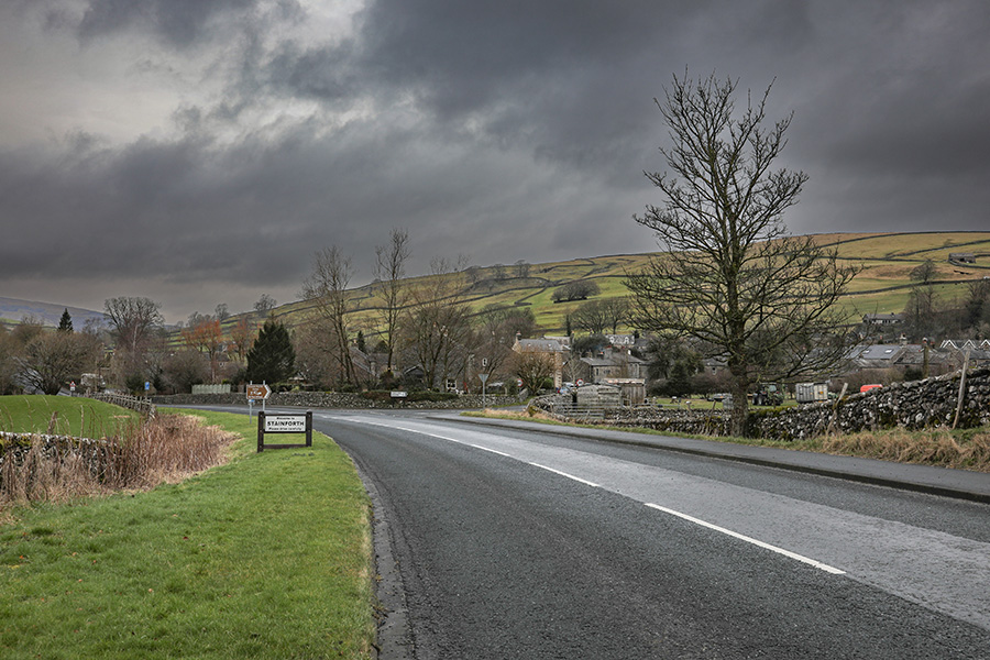
Stainforth
The road continues towards Stainforth, though rolling, the elevation is steadily increasing.
Distance completed: 11.63 miles
Total climbing: 944 ft
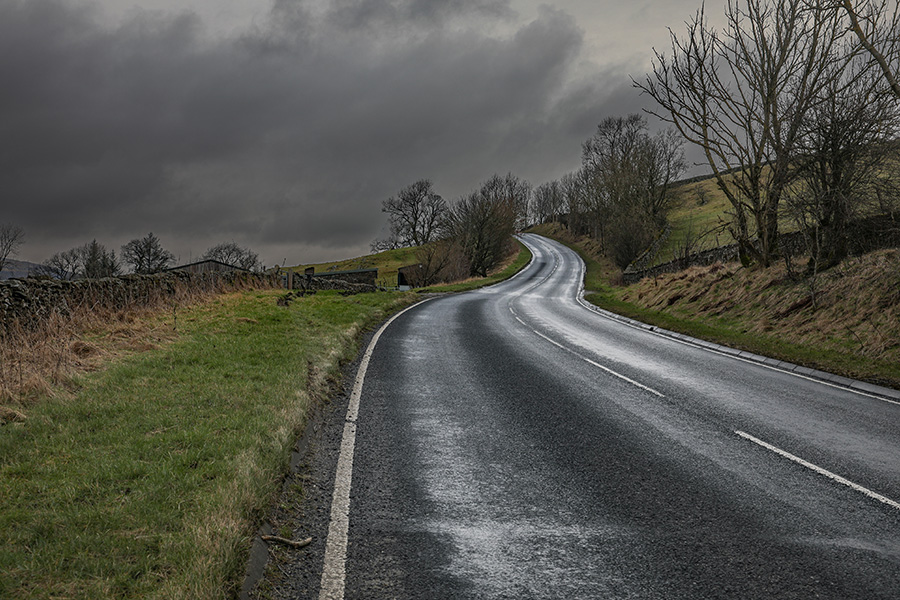
Sharp kick after Stainforth
The climb after Stainforth continues, ending in a short steep section.
Distance completed: 12.25 miles
Total climbing: 1012 ft
Approaching half way
The sharp kick is followed by an equally sharp drop. Once the speed and twisting bend have passed the half way point approaches.
Distance completed: 12.87 miles
Total climbing: 1075 ft
Helwith Bridge
The drop to Helwith Bridge is followed by a sharp right hand bend. Take care not to carry too much speed and avoid the mistake of taking the left turn!
Distance completed: 13.16 miles
Total climbing: 1119 ft
The flat run in to Horton
Here is another section where the time trialler will come alive. The run in towards Horton is flat and straight. Especially with a tail wind, this is a fine section!
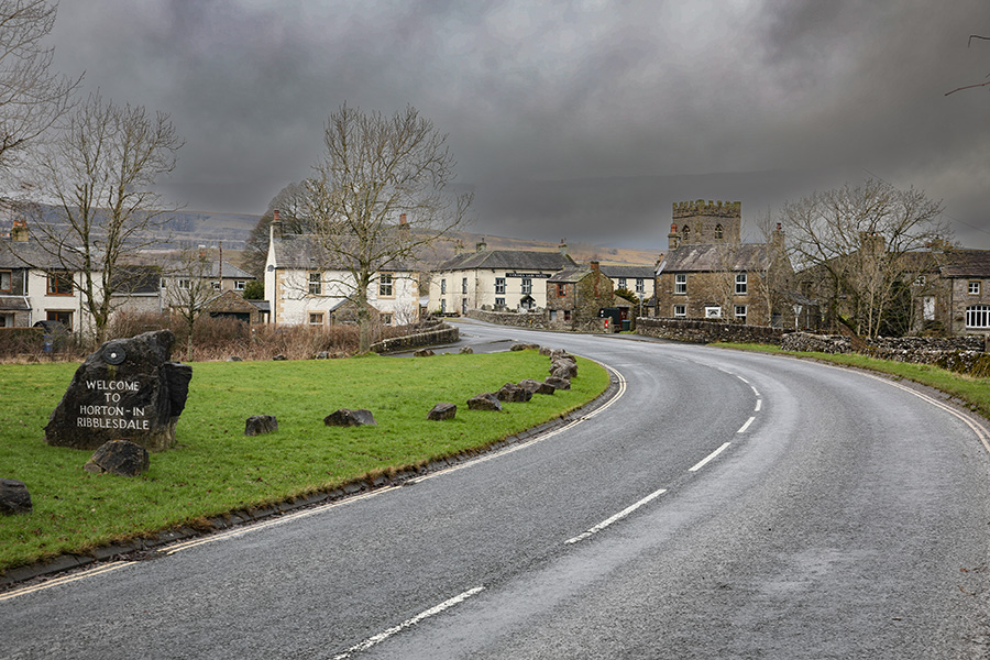
Horton-in-Ribblesdale
Take care in Horton villiage, it is often busy here.
Distance completed: 15.02 miles
Total climbing: 1176 ft
Horton-in-Ribblesdale Bridges
The bridges in Horton demand extreme care. After the one shown in the picture, there is an abrupt left turn and another narrow bridge immediately after. There will be marshals here.
Distance completed: 15.48 miles
Total climbing: 1196 ft
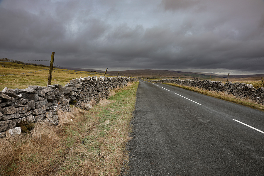
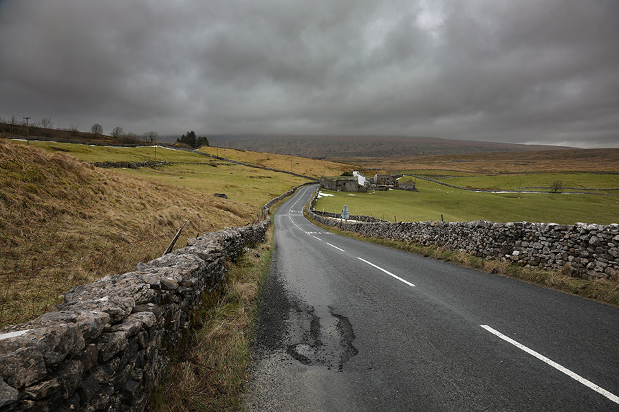
The open moor
After Horton, the exposure increases. Moorland scenery dominates. This section has a different character. Though steadily climbing, there are frequent interruptions with sharp bends. A headwind here can make for a grim battle.
Simon Fell
Simon fell can be seen ahead. The scenery is grand but this can be one of the toughest spots. Many miles are gone, legs heavy and the finish not yet near.
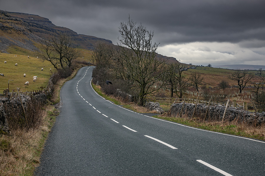
The bends!
One of the sharp twisting descents immediately after a sharp climb. These constant changes make keeping a steady rhythm challenging.
Distance completed: 17.50 miles
Total climbing: 1355 ft
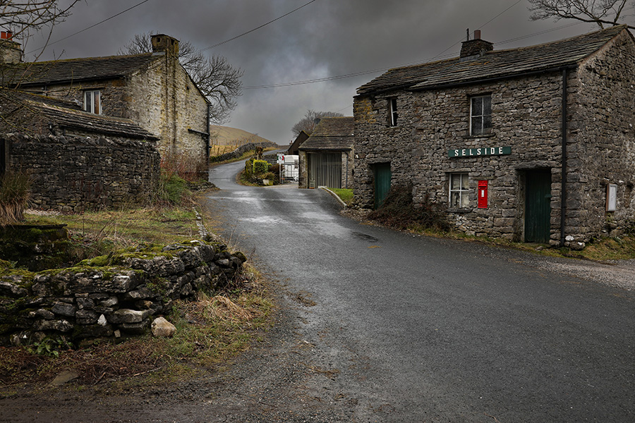
Selside
Another fast descent takes the road through Selside and into another short rise.
Distance completed: 18.15 miles
Total climbing: 1374 ft
The long straight
The long straight! Tailwind conditions here can be exhilarating. A headwind is another matter.
The long straight part 2
It is long but the end is in sight. The character of the course is about to change again.
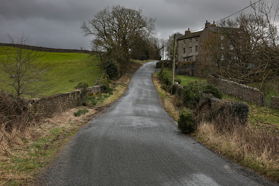
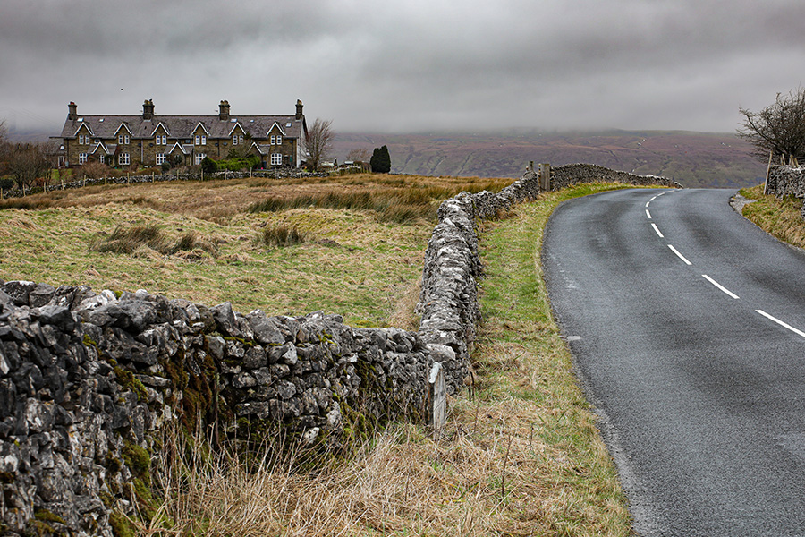
Railway houses
The straight behind, the railway houses herald the descent towards Ribblehead.
Distance completed: 20.00 miles
Total climbing: 1485 ft
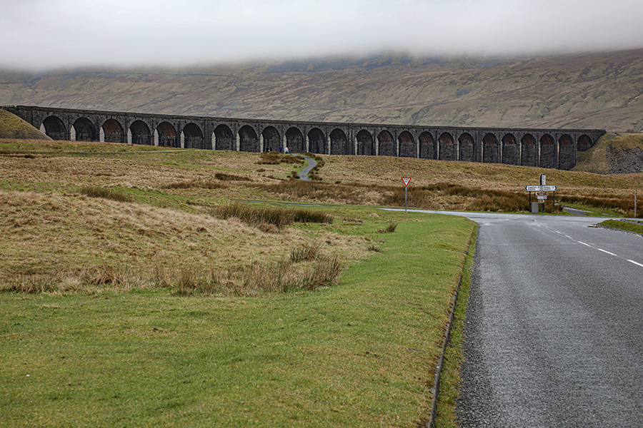
Descent to Ribblehead
Ribblehead is close, a fast descent with Whernside brooding in the cloud.
Ribblehead at last
A left turn at Ribblehead begins the final section of the course. Traffic is approaching from the right, you must stop if the way is not clear. The marshal will point the way.
Distance completed: 20.86 miles
Total climbing: 1492 ft
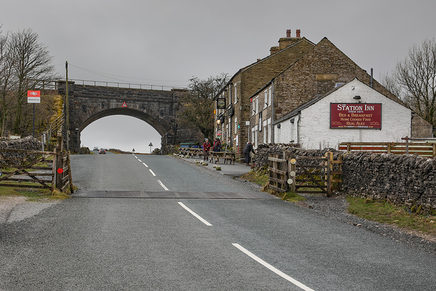
Station Inn climb
The final section is governed by weather. Seldom is the wind calm here. If it is a tailwind then this is time for elation: the Station Inn climb will be the last major effort. A headwind and it is going to be a battle for the final 5 miles to the finish.
The highest point
Close to the highest point at 1073ft above sea level. There are just under 5 miles to go.
Distance completed: 21.50 miles
Total climbing: 1581 ft
The descent begins
The highest point is behind but the course still has pain to inflict. Ever so gradually at first, the descent begins…
Approaching the Hill Inn
The road is about to make another plunge downwards – just beyond is the Hill Inn followed by one of the fastest parts of the course.
The Hill Inn plunge
The picture makes this look benign but it is steep and the speed here can be very high.
Distance completed: 22.83 miles
Total climbing: 1620 ft
The final effort
With the dramatic limestone scars following the flank of Ingleborough displayed grandly on the left, the final effort begins. With a tailwind, it can be almost no effort at all.
The White Scar ripples
The road ascends again to White Scar Cave. The undulation gives a series of false summits. With a headwind they seem unending.
The final summit
This really is it – the end of the climbing. The final summit of the course is just ahead.
Distance completed: 24.47 miles
Total climbing: 1629 ft
The final plunge
White Scar Cave is behind and just ahead is the final drop to the finish.
Distance completed: 25.62 miles
Seconds to go
The finish is near, just a few seconds more. The finish chequerboard will be in sight. Get ready to call out your race number as you pass the timekeeper.
The finish
And that is that! The finish! Congratulations, you have become one of the several thousand cyclists, professionals and amateurs, who have completed the Circuit Of Ingleborough.
Distance completed: 26.24 miles
Total climbing: 1630 ft